Leveraging vast experience in GIS, Remote Sensing, Telecom Projects, Network Engineering, and Utility Data Conversion and Migration, we guide projects from inception through to completion. Our consultancy encompasses project initiation, workshops, execution, and implementation, ensuring a seamless journey amidst the complexities of modern architecture.
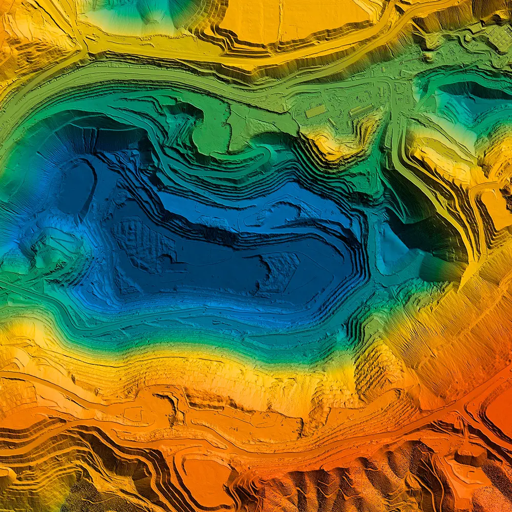
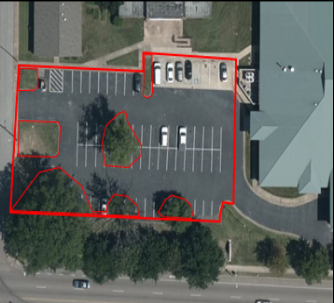
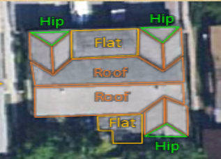
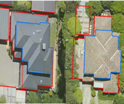
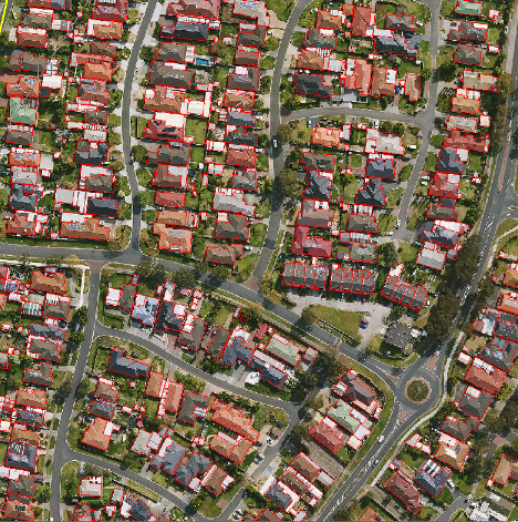
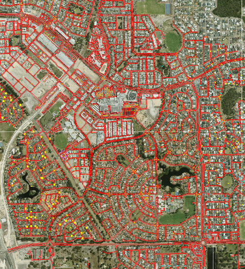
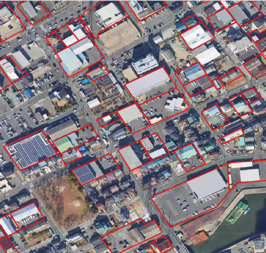
Ready to transform your project with expert GIS solutions? Enquire now to get started. At the heart of our approach is a commitment to quality, minimizing data iterations and effectively reducing our clients’ implementation costs. Our structured organization, robust capacity, and tailored solutions ensure that each project is executed with precision, aligning with our clients’ timelines and expectations. Understanding the critical importance of time, our delivery mechanisms are designed to align closely with our clients’ time zones. We work hand-in-hand with clients to fully grasp their needs and ambitions, prioritizing data quality and punctuality above all. Our goal is not just to meet deadlines but to exceed expectations. Our ultimate aim is to earn our customers’ trust through unwavering dedication to quality work and timely delivery. We believe that trust is the foundation of lasting partnerships and the key to building future cities that embody both technological innovation and architectural marvel. Our GIS services transform raw data into dynamic, insightful solutions. From satellite imagery to advanced LiDAR processing, we offer a comprehensive suite of services tailored to meet the intricate needs of our clients, ensuring accuracy and innovation at every step. — Land base Creation — GIS Mapping — Field Survey Data Interpretation — 3D Laser Scan Data Processing — Remote Sensing — LiDAR Data Processing — Map Conversion — CAD Services — Geo Referencing — Remote Sensing — Drone Data Mapping — AM/FM Services Showcasing precision in GIS: From digitizing details to terrain analysis across diverse projects. Rich & vast experience in the field of GIS and Utility Projects. 50 member team including 5 leads, 2 project leads, a coordinator, and a manager Executing complex projects with ease and delivering high productivity Known for the upright correspondence with clients
Empowering the Future of AEC: Precision, Innovation, and Partnership in GIS Services
Enquire Now
We deliver expert consultancy and project management in architecture, engineering, and construction, ensuring precision and efficiency from inception to completion.
— GIS SERVICES
Our Projects


WHY TECHNOSTRUCT
Learn More
Expertise, precision, and seamless project execution define our GIS services.
Domain Expertise
Team Strength
Process Oriented Approach
Project Management