It has become vital to improve resilience within urban infrastructures owing to climate change. Urban planners need to have technology that can allow them to be able to visualize data in complex ways. The last few years have witnessed the world facing natural and man-made disasters.
At such a vulnerable time, urban planners need to be able to balance between maintaining sustainability and providing security. GIS in urban planning can support urban planners in obtaining geospatial data that can be utilized to gain a better perspective on managing infrastructural development.
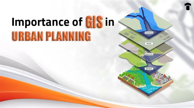
How is GIS relevant in Urban Planning?
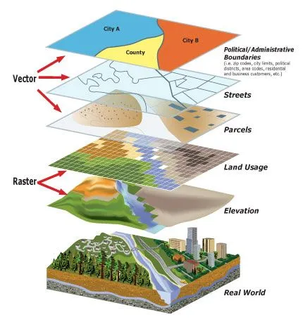
GIS technology is essentially an information system that is tasked with visualization, storage, analysis, and interpretation of geographical data. Its relevance in urban planning is mostly associated with its ability to enhance data visualization. GIS in urban planning will improve the ability to regularly monitor fluctuations over time.
Implementing GIS in urban planning will allow planners to create comprehensive designs to manage density. Using GIS Data one can run multiple queries and analytics to gain perspective on how to manage both regulatory demands and existing infrastructure. In this way, GIS in urban planning can help scout for the best locations for development purposes and the allocation of resources.
The importance of GIS in urban planning contributes to balancing competing priorities and solving complicated problems. It considers the challenge of space scarcity and helps optimize building placements. Through the optimized implementation of Various software that utilizes GIS data, stakeholders are provided with a broad picture of the current situation that leads to better decision-making.
The importance of GIS implementation in today’s urban cities
The increasing population in the last decade has brought forward settlement challenges. Simultaneously, it has also increased energy consumption and urban challenges, such as flooding, congestion, etc. At such a time, it becomes evident for urban planners to employ the use of data-driven methods.
Land planners need to constantly analyze to make new developments that will be less prone to such disasters. Using GIS in urban planning involves synthesizing information from various sources to explore potential solutions.
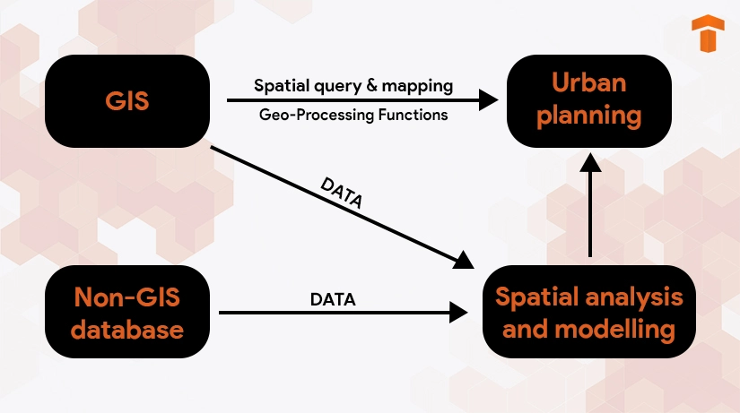
GIS facilitates urban growth by allowing more people to be accommodated in a smaller area. Urban planners can utilize spatial query and mapping to analyze existing city layouts. This will make it easy for planners to gain perspective on conflicted areas and manage sustainability mostly by overlaying existing land development across land suitability maps.
Applications of GIS in urban planning
GIS in urban planning makes it possible for urban planners to find the correct balance when it comes to housing, services, manufacturing, development, and so on. Urban planners can manage the gradual growth of urban regions through GIS in evaluating urban infrastructure development needs.
Here are a few real-world examples where GIS is at work:
● Review and analysis for land use planning
● Reviewing the environmental impact and assessing for its efficient management
● The preservation of historical sites
● Special mapping of delivery of utilities and planning, especially for service interruptions
● Constant check some regulatory compliance during the development process
● Identification of natural or man-made disasters
● Conducting population tracking, including migration and demographic challenges
● Examining the current growth patterns and conducting development accordingly
● Mapping of both community Assets and community risks
● Combining the different layers of data to evaluate the socio-economic status of the current demographic and assessing the factors affecting growth
● Analyzing migration patterns, including current and future trends
● Examining Capacity Issues and Asset Management
● Identifying factors including crime rate, infrastructure challenges, urban city problems, etc.
Thus, GIS in urban planning is contributing towards providing a detailed look at the city as a whole. It is changing the way planners look at urban development planning.
The usefulness of GIS in urban planning for planners
The use of GIS in urban planning has its own set of benefits. Here’s a look at what kind of advantages it provides.
1. Access to Crucial Information
The technology allows for simplifying the process of organization and collection of information. It can easily retrieve information from various sources, allowing planners to have a comprehensive outline of the city plan. Furthermore, it also allows for mobile viewing, which further improves its accessibility.
2. Improved Mapping Capabilities
An important and effective feature of using GIS is storing data in one Central location. In this way, it can easily boost credible map locations and provide them in real-time. Similarly, the effectiveness of special mapping and thematic mapping is increased for urban planners. It also helps in reducing data storage costs.
3. Communication Management
The easy accessibility is associated with improved communication. The information is available in a central database, which reduces the time for urban planners to hunt down information. The technology provides the organization of different datasets chronologically, leading to the simplification of information handling.
| Read More: The Integration of GIS with BIM: An Explanation
Conclusion
Thus, to conclude, GIS in urban planning can contribute to providing clarity to urban planners about city data analysis. For urban planners to have access to every dataset can improve the feasibility of proposed projects. This will enhance the ability of urban planners to identify solution space to balance both suitability and infrastructural development.
FAQs
Q1. What is the full form of GIS planning?
Ans. The full form of GIS is outlined as a Geographic Information System. It is essentially a system that is computer-based and utilizes data to conduct analysis of geospatial data.
Q2. Can GIS be used to plan for Smart Cities?
Ans. Yes, GIS is often considered to be one of the pillars of the foundation when it comes to smart city development. Using GIS makes it possible to analyze and contextualize the existing dataset collected from different sources. In this way, it becomes easier for city planners to plan for sustainable and technologically advanced cities.
Q3. Can GIS be implemented in urban sprawl?
Ans. Yes, because GIS easily allows for the manipulation of different kinds of datasets from multiple sources. Considering the fact that mapping urban phenomena is considered to be an essential part of GIS planning, quantifying urban sprawl can help in mapping its spatial distribution.

The construction sector is one of the Read more

Mechanical, electrical, and plumbing systems (MEP) today Read more

Imagine donning a pair of sleek glasses Read more